Click the thumbnails to display a larger image. If no back button is provided, click your browser back button to return here.
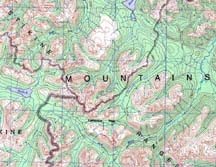
Setting the sceneThis is the area we covered during ten amazing days in July 1999. We started at Tucho Lake (centre west), making our way to and through Lamarque Pass; then SW to about the "A" in "RANGES". After a day's diversion along the creek coming from the south we made our way down Jack Stone Creek to where it joined the Frog River (just above the "S"). Then we headed NW to end at Denetiah Lake in the top centre. |
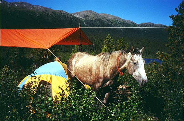
Uh, there's a horse in the camp!After a while, it didn't seem so odd. But at first, having these big animals just wandering through amongst the tents and cooking area was startling! They didn't step on anything though. This was at Tucho Lake where we started. |
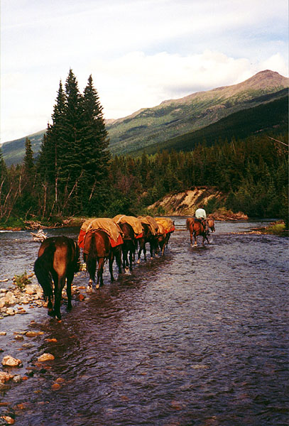
Follow the leaderSome of the herd follow Wayne on Ginger across a gravel bar on Jack Stone Creek. At this stage, there was no sign of anyone else having been along this route. Real wilderness. |
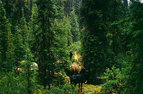
Herd amongst the greenIt was cool and raining - not too hard, but enough to warrant having a fire to ward off the chill during lunch. Katharine caught this picture of the horses in the forest. |
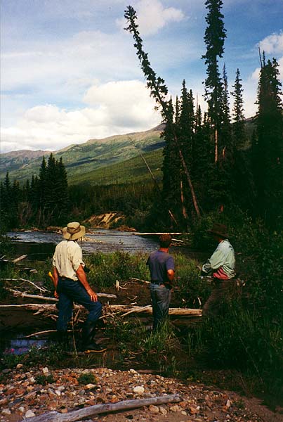
Where to now?Eric, Tom and Wayne survey possible routes down Jack Stone Creek. We'd been cutting trail quite a bit that day but it was interspersed with lovely views and exciting crossings. |
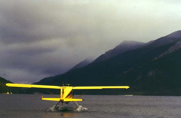
Are you sure you can fly into that?Wayne and Urs leaving Denetiah Lake - headed for the low area at the left wing. By the time Urs came back for us a few hours later, the local clouds had broken but there was similar weather between here and Muncho Lake. |
We have many more images, both personal and for use in articles. Drop us an email to ask any questions or give us some feedback.
1999-10-26 EJF