California March 2001
|
|||||
|
|
|||||
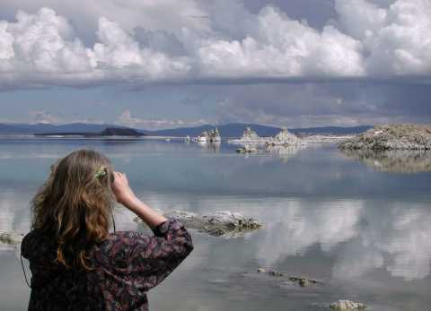
With no natural outlet, Mono Lake has become extremely salty. Mineral-rich water coming up in springs under the lake mixes with the salts to make the calcium carbonate "tufa" towers that Katharine is examining. A series of tunnels and canals bring water from here to Los Angeles - some 400 miles away - and caused the level to drop 45 feet before environmentalists successfully lobbied for controls.
|
|||||
|
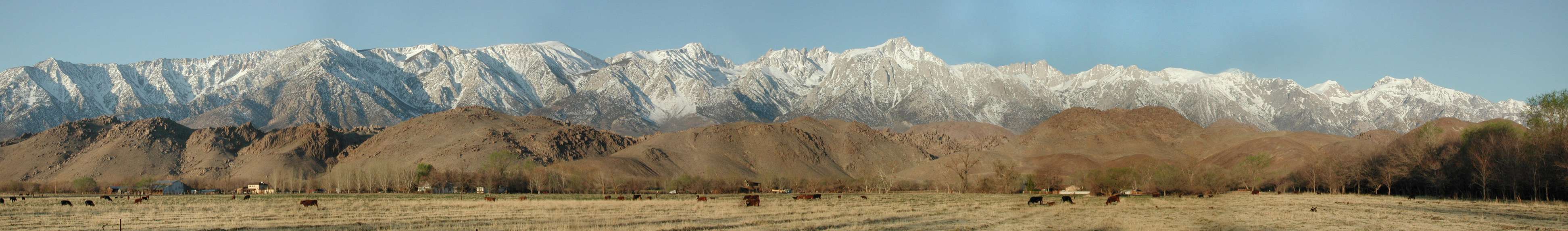
This was our morning view from the Best Western motel at Lone Pine. Roughly in the center, at 14,494 feet, Mt Whitney is the highest peak in the continental US. In the foreground are the Alabama Hills, where numerous movies have been filmed to take advantage of the dramatic scenery: huge rounded boulders with the mountains behind. The half-hour drive is well worth taking: pick up a free interpretive sheet in town and find your way to eerily-familiar settings from old cowboy movies - and even northern India for the movie Gunga Din! We can highly recommend staying in Lone Pine and wish we'd left ourselves more time to explore the nearby hills. It is the last real town before Death Valley; clean, helpful people, good restaurants... the Best Western was inexpensive but spotless and comfortable - and included a serve-yourself breakfast with a great selection of cereal, fruit, muffins and coffee. We'd go back.
|
|||||
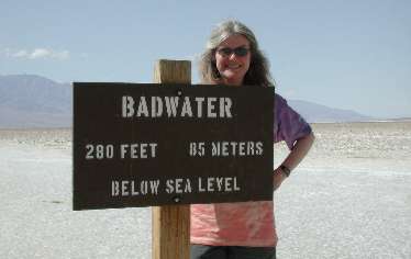
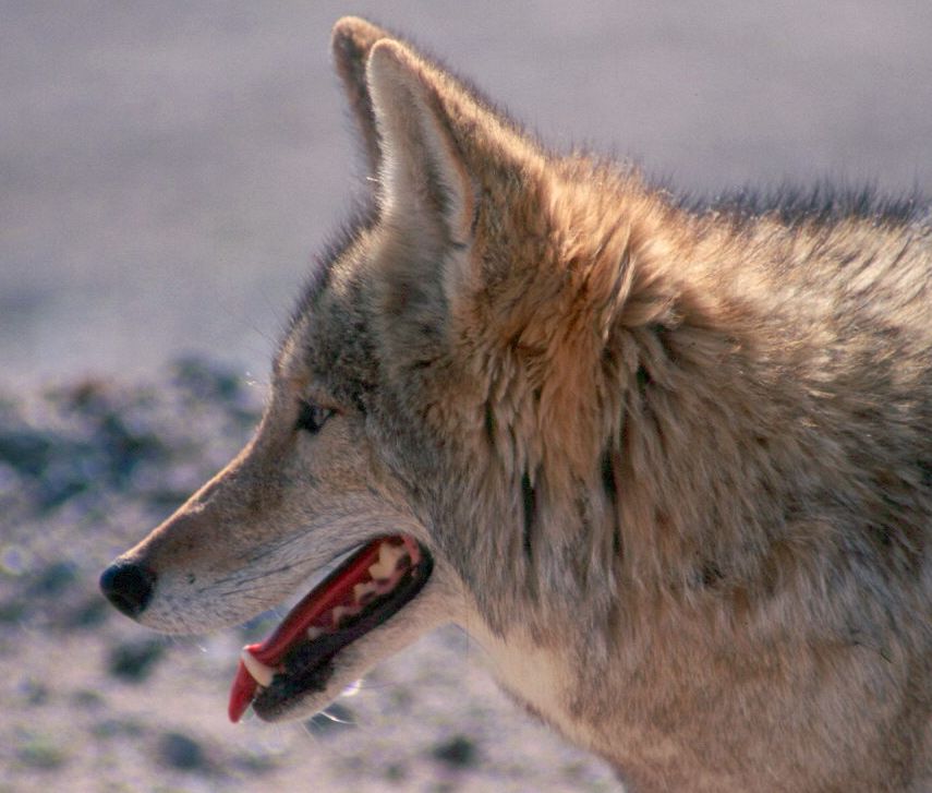
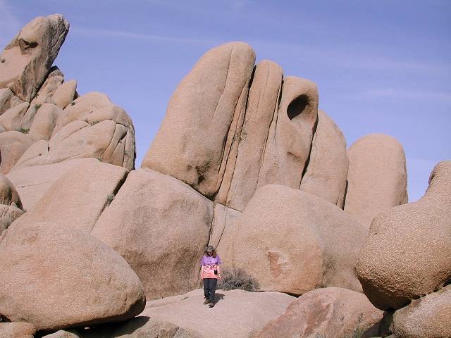
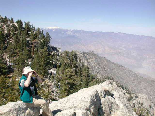
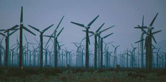
Both of us had always wanted to go through Death Valley. And not particularly liking the heat, we were glad to be there in March rather than August! The road from the NW descends for 8 miles down a huge alluvial fan to the bottom of what was once a land-locked lake. Mountain ranges on either side create a rain shadow and trap the heat to make it the lowest, hottest and driest place in the US. The limited accommodation within Death Valley is expensive and we'd planned to just drive through this time. However, next time we'd plan to stay at one or more of the good camp sites and do some hiking. As we left the driest part, we were surprised to see a coyote at the roadside. When we stopped, he didn't run and looked tired and thirsty as we carefully took some close-up shots. We were somewhat relieved - and amused - to hear from a warden a bit later that the coyotes become very good at tricking tourists to feed them: apparently several are well-known to run off at the sight of a park vehicle! (This image was scanned from a slide taken with the 300mm lens on our Nikon F70.) We continued south through the Mojave National Preserve to be able to explore Joshua Tree National Park the next morning. The boulders at Joshua Tree are similar to those in the Alabama Hills at Lone Pine - and also to the boulders in Hyderabad in India's Deccan Plateau. From a viewpoint, we were able to look out over the whole Coachella Valley. A steady flow of smog from Los Angeles powers thousands of windmills along the highways through a gap in the mountains at the northern end. Then, incongruously green against the desert, the walled communities and golf courses of Palm Springs blend gradually into extensive fruit and vegetable regions further south around the Salton Sea. Just outside of Palm Springs, an aerial tramway whisked us up almost a mile from the heat to snow! Earlier in the year, people bring up skis and head further up for alpine cross-country skiing and even winter camping. We hiked around along cliff edges that offered dramatic views of the valley from the western side.
|
|||||
|
|
|||||
|
|||||
|
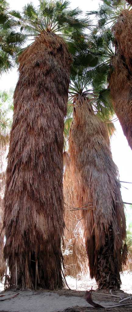
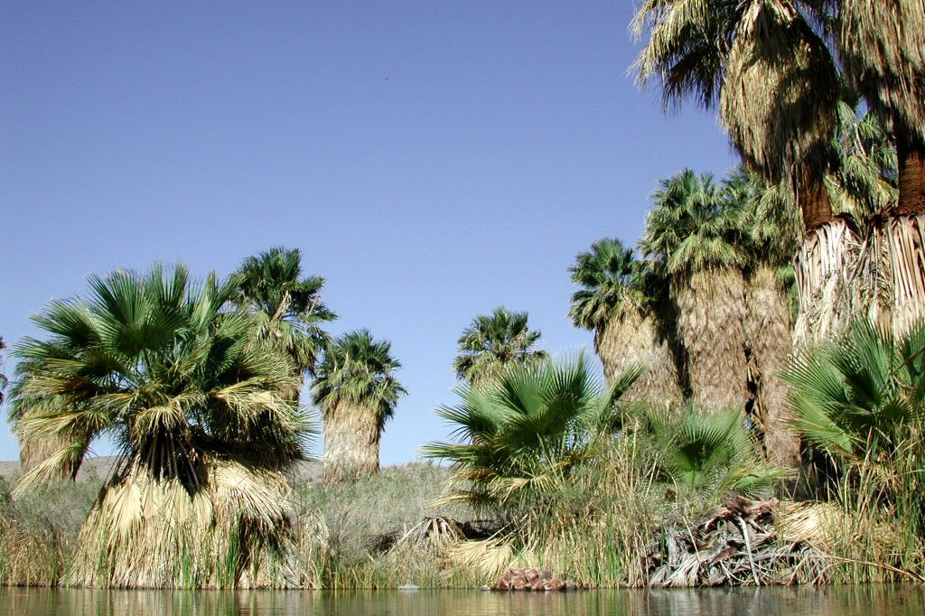
The palms grow where water is close to the surface - here it has formed a classic pool. The water is at the surface in this part of the desert thanks to the San Andreas fault: as water makes its way underground from the nearby hills, it is forced to the surface when it hits an impervious layer of clay formed as the sides of the fault grind past each other. |
|||||
Along the Big Sur coast
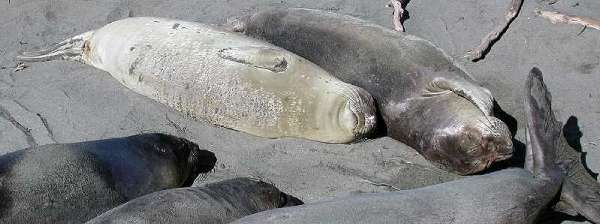
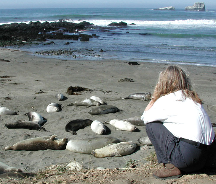
Ah, the life... just hanging out with friends and taking in the rays! Seals on the beach. We'd been looking for elephant seals but didn't expect to find such a lot of them! There's a very good interpretation stop just north of San Simeon - and, as you can see, we were able to get good views. We didn't see any of the males with their distinctive "snouts" but gather that they only come around in mating season. Scientists have tracked males diving to as much as 1,530m (5,000 feet) as they forage for food along the continental shelf - ranging as far north as the Gulf of Alaska and the eastern Aleutian Islands.
|
|||||
|
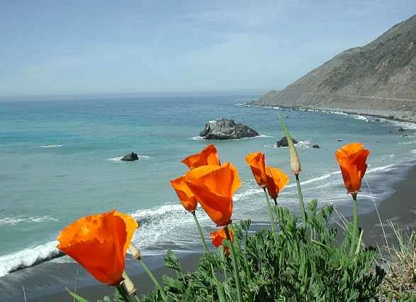
We thoroughly enjoyed poking along this road: just as well there are lots of pulloff places because there are views and opportunities for little hikes around almost every corner!
|
|||||
|
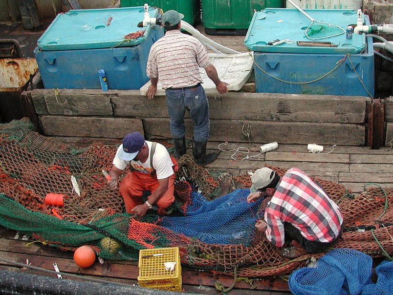
Although it is definitely a tourist trap, the wharf at Monterrey is a fun place to stop. We'd been surprised to see sea otters amongst the boats before so we took the time to wander around. We only saw one this time: floating asleep in a typical upside-down pose with little arms crossed on his tummy. The most interesting of the two wharves is the commercial fishing one: boats were unloading their catch and there were lots of sea lions, birds and seals. This picture of fishermen repairing their nets is large but is a good example of why we are very happy with the capabilities of our digital camera. The colours both on screen and in a printed version are rich and crisp.
|
|||||
|
|
|||||
|
|
|||||